
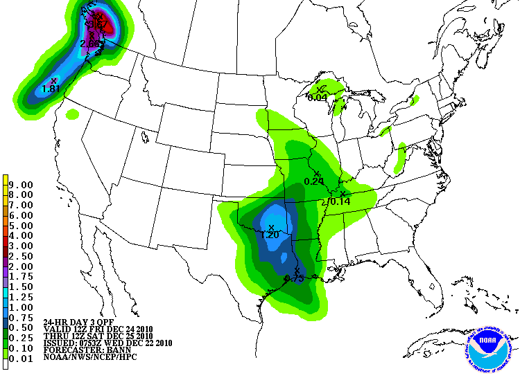
The HPC is currently forecasting a moderate chance for snow of 4 inches or more across portions of Missouri on Christmas Eve:

This band of locally heavier snow will then spread East/Northeast into portions of the Ohio and Tennessee Valley later on Christmas Eve into Christmas Day. Folks with travel plans into this region should check local forecasts for later updates. We'll also post another, more generalized, update here tomorrow.
In addition, Christmas Eve will bring a chance for measurable rainfall to much of the Eastern two-thirds of Texas and much of Oklahoma. Many locations across this region have gone 30 days or more without rainfall. Here is the latest HPC forecast of rainfall potential for Christmas Eve:
Somehow I don't think that Santa and the reindeer will feel too bad about getting a little wet across this very dry region!
No comments:
Post a Comment