Sorry for the lack of posting and tweeting yesterday late afternoon / evening, but we had no internet, data or cellphone service much of the time (or very slow when we did have it). To make a long story short, we saw several storms with strong rotation, wall clouds and even a few funnel clouds, but none produced a tornado on the ground (at least not that we could see - there was a lot of rain associated with these storms as well, which obstructed our view in some cases). If the network permits, I'll upload a few photos shortly.
We were in the Russell/Hill City/Stockton areas of northwest Kansas for most of the chase, and ended up in Grand Island, Nebraska about 2:30 this morning. We were trying to reposition in anticipation for today's threat area, which is taking us to the northeast corner of South Dakota / southeast corner of North Dakota (see latest SPC outlook map below). Initially we are targeting the Aberdeen area.
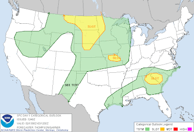
It appears supercells with tornadoes will be possible in this region late today, most likely after 4-5pm CDT. That gives us plenty of time to get into position.
The data network is likely to be sparse again today, but I'll get a post or tweet in whenever possible.
No comments:
Post a Comment