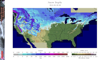
Recent images from NOAA indicate that only 22% of the nation has snow cover on the ground. The last time that there was less than 30% snow cover at this point in January was back in 2007, which came in at 27%.
The series of images below show the observed snow cover (via the NOHRSC) for today, January 5, for each of the last 5 years, beginning with today's image:


Particularly after last year's heavy snow season across the West, the "snow drought" (as some are calling it) is striking. Take a look at this image of snow cover across the Great Basin today (with a mere 4% of the ground covered):


The series of images below show the observed snow cover (via the NOHRSC) for today, January 5, for each of the last 5 years, beginning with today's image:


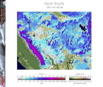
...and here is the image from 6 years ago, with 27% snow coverage in 2007:


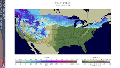
...versus last year on the same date, when over 80% of the ground was covered:

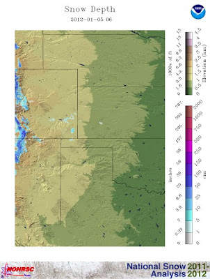
A similar "snow drought" is noted across the central Rockies when you compare the snow coverage today:

...with that of last year on the same date:

Not only is there far less snow cover present, but the depth is far less this year as well, which is beginning to take a heavy toll on ski season.
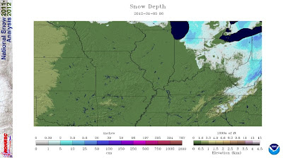
There are other impacts to be considered with regard to the lack of snow: a very important one being the potential for damage to the winter wheat crop. You see, snow cover actually acts somewhat like a "blanket" to help protect the Midwest and northern Plains wheat crops from being damaged by cold, arctic airmasses in January and February. As you can see on the images below, the lack of snow cover in the winter wheat belt is astounding:


The snow cover itself, as well as the associated moisture that soaks into the ground, help to keep ground temperatures from reaching potentially damaging levels. Such a barrier may not be in place should arctic air invade the region later this season (and at least one such invasion appears likely next week).
On the positive side of the coin, the lack of snowcover, and the resulting lack of moisture, would tend to lessen the impacts of some of the river flooding that typically takes place each year as a result of the snowmelt in the spring. This is particularly the case across portions of the upper Mississippi River Valley region. While this is good news, at the same time, moisture from the snowfall also contributes to a significant portion of the winter and early spring precipitation totals across much of the region.
If the entire winter season indeed ends up with below normal snowfall, and as a result, below normal water equivalent precipitation, this could lead to some real problems with warm season crops in some areas of the Plains and Midwest. This will particularly be the case if rainfall also trends below normal during the spring and summer months.
If you enjoy reading 'The Original Weather Blog', please be sure to "like" our facebook page and/or follow us on twitter!
No comments:
Post a Comment