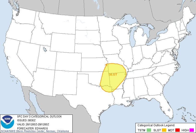
A very strong middle and upper-level storm system and associated surface front will move across the central and southern Plains on Tuesday afternoon and evening. Severe thunderstorms are likely to develop along and ahead of these features, generally corresponding with the area outlined in yellow on the image above.
Large hail, damaging winds and tornadoes will be possible with this activity.
The risk of severe weather includes the cities of Tulsa, Ft. Smith, Little Rock, Texarkana, Joplin and Springfield.
If you live across this region, take the time to review severe weather safety and preparedness tips ahead of time. Make sure that you have necessary supplies and have a sheltering location in mind should severe weather threaten your area on Tuesday afternoon or evening.
I will have a much more detailed update on this situation tomorrow, so please watch for that post. By that time we'll be able to be much more specific as to the expected location, timing and potential magnitude of this event.
If you enjoy reading 'The Original Weather Blog', please be sure to "like" our facebook page!
No comments:
Post a Comment