
Widespread and/or organized severe thunderstorm activity is not currently expected across the U.S. for this Good Friday.
Thunderstorms are forecast within the green shaded areas on the above image today and/or tonight. Some of the storms may become strong to locally severe near the words "See Text" on the image (over the Florida peninsula, the Texas Panhandle into central Kansas and portions of the Dakotas).
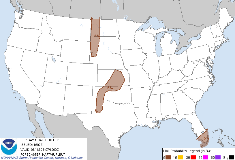
Isolated strong to locally severe thunderstorm development is possible along a surface dryline over the Texas panhandle late this afternoon or early this evening. This activity will diminish toward or just after sunset.
Thunderstorms are forecast to develop tonight, after Midnight, over central Kansas and move South/Southeast toward northern Oklahoma. A few of these storms may produce hail near severe limits.
In Florida, isolated to scattered strong thunderstorms are expected to develop along the sea breeze front from the East coast and spread Westward during the day today.
In the Dakotas, a few strong to locally severe thunderstorms may form along a frontal boundary late this afternoon into this evening.
In particular, some of the stronger storms this afternoon and evening may produce hail and/or wind gusts approaching severe limits, especially within the brown shaded areas (corresponding to the regions described above) on the image below:
While widespread and/or organized severe weather is not expected today, folks in the above mentioned areas should remain alert and listen to NOAA Weather Radio or local media for any possible warnings.
If you enjoy the blog, please click on the icons below to "Like" my facebook page and/or follow me on twitter. You'll find posts at these locations that aren't always on the blog, especially during rapidly changing weather situations...


No comments:
Post a Comment