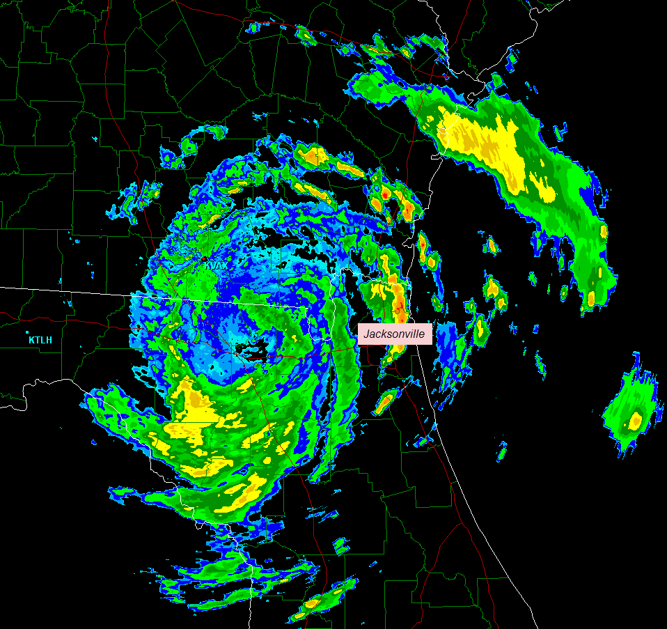
The above image was just taken from the Valdosta, GA area doppler radar site. You can see the center of Tropical Storm Beryl located 15 or so miles to the North of Lake City, FL, or about 15 miles South of the Georgia state line.
Widespread reports of 50-60 mph wind gusts continue, primarily on the Eastern side of the system over southeast Georgia and northeast Florida, with widespread downing of trees and power lines.
The other major threat at this time is very heavy rainfall. Ironically, much of this region is in a severe drought, but anytime you get several inches of rain falling in a short period of time, there will be flash flooding threats. The image below shows the radar's estimate as to the total precipitation thus far. The brighter red shadings indicate 4-6 inches of rain, while the yellows indicate 2-4 inches so far:

Isolated tornadoes will also be a threat, primarily with thunderstorms that take place in the upper-right quadrant of the storm (with respect to the location of the center). In the near term, this will primarily be over the extreme northeast corner of Florida, and southeast Georgia.
For all of the latest satellite and radar imagery, as well as updated track and intensity forecast information throughout the day, please see the dedicated page on Tropical Storm Beryl on our sister site, WeatherGuidance.com.
For more information, including "live blogging" during rapidly changing weather events, please be sure to follow me on facebook and/or twitter:


No comments:
Post a Comment